
Lenten rose. New Chrysotype contact print. Helleborus orientalis, also known…
South West Tasmania – Mark Darragh
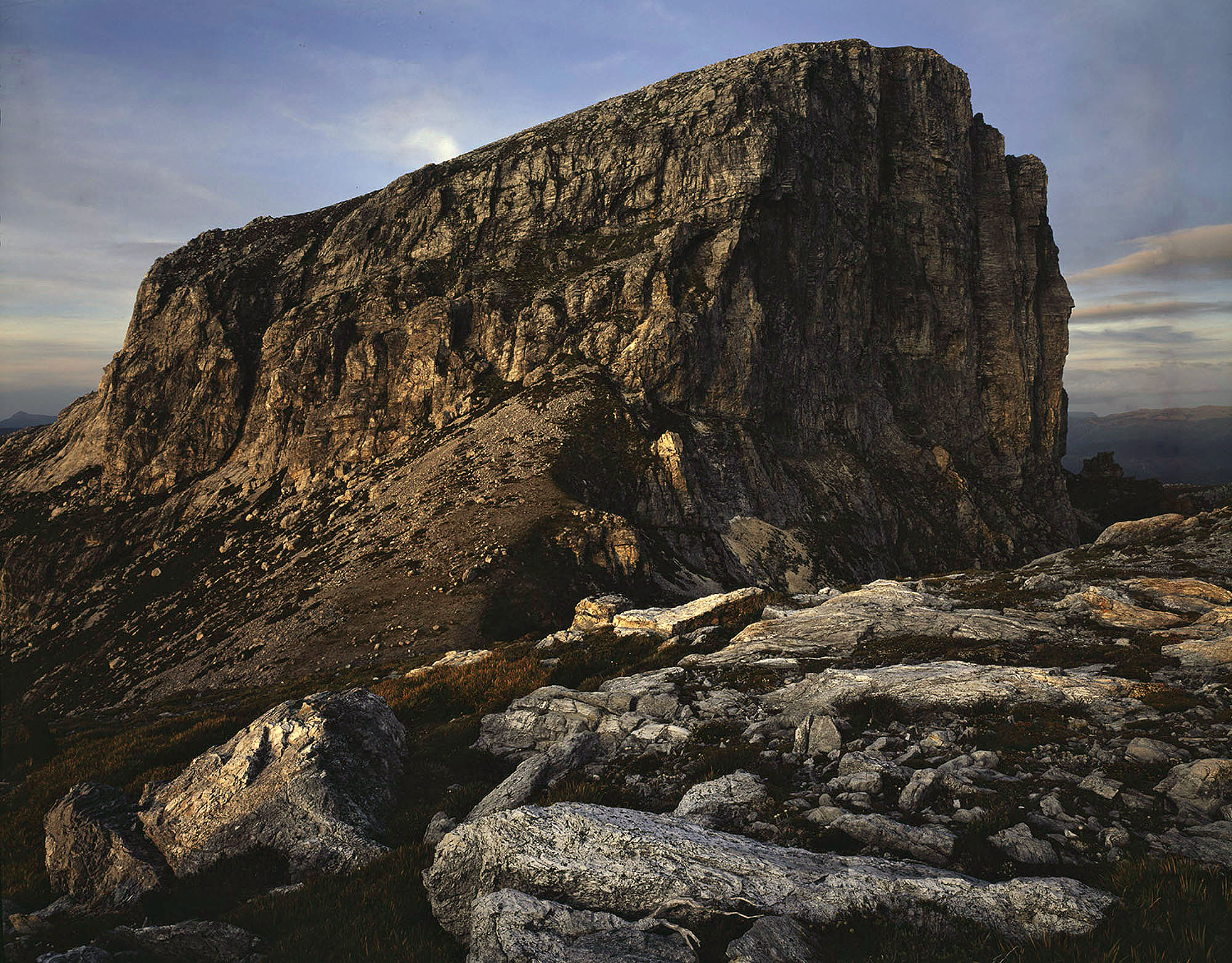
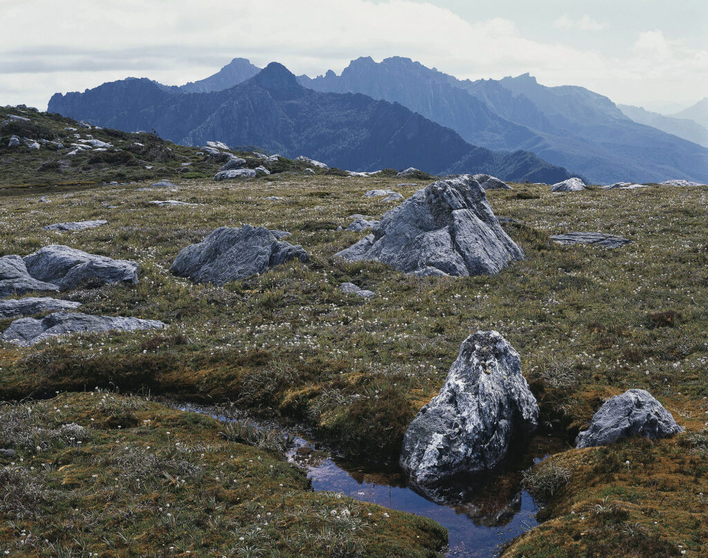
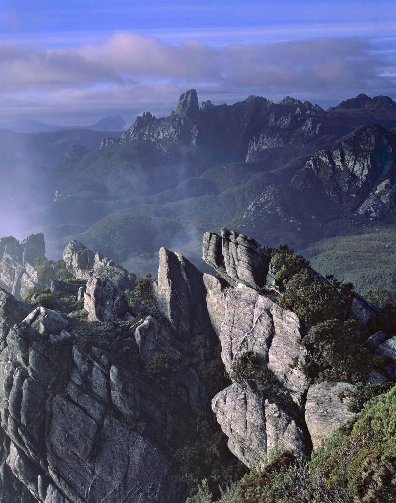
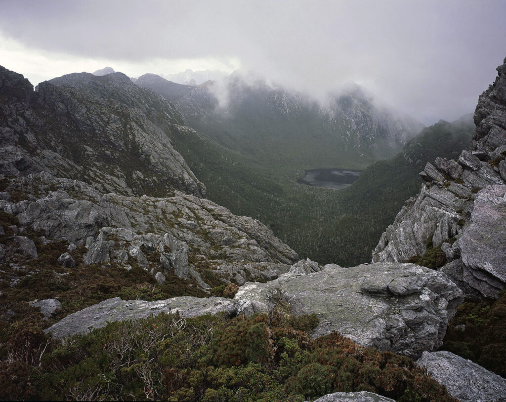
You feel a change as you enter South West Tasmania. Driving west from the pastoral valleys of the Huon or Derwent Rivers, the landscape quickly becomes more intense and brooding. The approaches to the South West are by no means flat, but they seem benign in comparison to the rugged quartzite and dolerite precipices or the deep, forested valleys and gorges that unfold in front of you. More often than not, you’re greeted by cloud and mist—sometimes rain, sleet, or snow.
My time in the South West has always been eventful. I’ve spent days bunkered down, sheltering from driving rain as gale-force winds tore across the mountains. Those days are more than made up for by the good memories. Hours spent watching an ever-changing panorama of shadow and sunlight dancing across the peaks, ridges, and Button Grass covered plains below. Hot, still days when the air is alive with birdsong, the buzz of insects, and sweet with nectar from wild flowers. Watching Mountain Skinks glide and tumble through the branches of Leatherwood as they search for food. Most of all, the days when cloud and mist clothe the mountains and forests, saturating the landscape; when the plants and even rocks seem to be lit from within, the soft light bringing out an intensity of colour that appears super-real unless seen with one’s own eyes.
South West Tasmania can be a challenging place to walk, let alone photograph with a large format camera. You can see the west and south coasts of Tasmania from many of the mountain ranges in the South West. Lying within the Roaring Forties, the area feels the full force of the weather sweeping off the ocean. On my first two photographic trips, my 4 x 5 camera never came out of my pack, let alone being set up to expose any film. Those early visits captured my imagination, and I return as often as possible.
The area holds an important place in the history of Australian photography, and it’s personally important to me as a photographer, both directly and indirectly. The campaign to stop the flooding of Lake Pedder in the 1970s and the Franklin campaign in the early 1980s inspired and galvanised a generation of photographers to share their work with the wider public and highlight the need to value and protect our wild areas. It was the work of wilderness photographers such as Chris Bell and Peter Dombrovskis in Tasmania, and particularly Grant Da Costa in Victoria, who inspired me to begin photographing with a large-format camera over twenty five years ago.
Following the Franklin Campaign, much of South West Tasmania was reserved within the South West and Franklin-Gordon Wild Rivers National Parks, which, in turn, are part of the Tasmanian Wilderness World Heritage Area, first placed on the World Heritage List in 1982. The TWWHA is one of only two sites in the world to qualify for 7 out of the 10 classification criteria evaluated for World Heritage status.
Although South West Tasmania has a timeless, even primordial feel, it would be a mistake to think that this is a static, unchanging landscape. And, although much of the area is reserved, ongoing threats remain. There are still proposals to exploit areas of significant outside boundaries of the national parks and a continued push for ever-increasing development within them. An even bigger threat, which is blind to park boundaries and World Heritage protection, is that of climate change and fire. In my recent trips to the South West, the impact of fire is becoming increasingly evident.
I’m truly thankful to have had the strength and ability to visit this special landscape for over thirty years, and yet I feel I have only just begun to explore its very fringes. The photographs presented here are a small sample of my work and give just a taste of what a remarkable place South West Tasmania is.
Further reading
David Neilson’s recent book, Chasing Mountain Light, details some of the early history of rock climbing in the South West Tasmania, along with David’s beautiful photographs
Chris Bell – Primal Places
The following books are out of print but not too difficult to find in second-hand bookshops.
The South West Book – produced by the Australian Conservation Foundation and edited by Helen Gee and Janet Fenton. Although first published in 1978, it contains a wealth of information on the history and natural science of area.
Wild Rivers – Peter Dombrovskis and Bob Brown
Les Southwell – The Mountains of Paradise
Main photograph top of page: Evening, Frenchman’s Cap, Franklin–Gordon Wild Rivers National Park.
Previous Post: Ian Lobb and the Black Range – David Tatnall

Such wonderful and exquisite photos of the sublime Mark. Thankyou for sharing. Those wild area locations you photographed in require the photographer to have a very high level of fitness and extensive bush walking skills — which I just don’t have. So I will never walk in the magnificent, rugged country of the Arthur Range.
A question :– how did you access the Western Arthur Range . Was it via the Port Davey Track from the trailhead near the Huon Campground at the end of the Scotts Peak Dam Road?
Thank you, Gary. I have mixed feelings about sharing photos of the area. Twenty years ago, according to park rangers I spoke to on the track, visitation to areas like the Western and Eastern Arthur Ranges was limited or in some cases decreasing. That has all changed in the last ten or so years as these places receive more exposure, primarily through social media. Increased visitation has meant that tracks have been hardened and upgraded which in turn makes for easier to access. Unfortunately not everyone who visits has the awareness or respect for these wild places to treat them with care they deserve. It’s a real conundrum for park managers.
Yes, all my trips into the Arthur Ranges have been via Scotts Peak and the Arthur Plains. For those who aren’t up for a multiday, the view from end of the Scotts Peak Road and Red Knoll lookout to the Western Arthur Range to the south is quite spectacular ……. on a clear day!
HI Mark,
It does look as if access is changing yet again in the South-West National Park with parts of this area being sold to private interests in the form of privately operated huts on public land for the benefit of private walking tours run by private companies.
There is a current proposal to put six luxury accommodation huts on the South Coast Track. This is designed to open the area to a greater range of tourists. I understand that the company behind this Experience Co, based in Queensland and run by the CEO and Chair of Tourism Australia. Conflict of interest?
These expanded range of tourists would fly to Tasmania from interstate or overseas and they would have paid big $$ to do the walk and stay in the private luxury accommodation. The probable locations are Black Cliff in Cox Bight, western side of Louisa River, Purrar Pt in Deadmans Bay, Milford Creek at Prion Beach, middle of Granite Beach and on the point east of South Cape Rivulet.
Presumably they fly into Melaleuca airstrip and then walk to Cockle Bay. Wouldn’t that require a major upgrade of the track (it becomes a hardened path) and at least 5 bridges to be built? How will these lodges be serviced? By helicopter? Who maintains and repairs the huts?
It would seen that private accommodation—i.e. huts and lodges– for walkers within national parks is happening park by park and state by state, with the proponents of them being our peak tourism bodies. The DNA behind a lot of these proposals was first developed in Tasmania with the Three Capes Track in 2015.
What’s driving this process is profit and its not for conservation or environmental protection.
Some background:
Part 1: https://wild.com.au/conservation/luxury-lodges-means-wilderness-lost/
Part 2: https://wild.com.au/conservation/luxury-lodges-means-wilderness-lost-part-2/
Yes, Gary, There has been much controversy in the bushwalking and conservation communities about the proposal to “upgrade” the South Coast track. There is a similar development underway in the West Coast Range in Tasmania.
This mirrors what is happening or being proposed in other states. In Victoria, for example, Parks Victoria is pushing “upgrades” to the Falls to Hotham Alpine Crossing, and the construction of huts along the remote Wilderness Coast. There have already been private developments as part of the new Grampians Peak trial. The cost of these private huts is hundreds, if not more than a thousand dollars per night, the rationale being that high-end accommodations and hardened tracks make parks “accessible” to more people. Under the Falls to Hotham proposal, there will be exclusion zones, which means others are not able to camp near or use the new facilities.
Stunning work.