
Folio: Mark Darragh
Tasmania’s Tyndall Range
The Tyndall Range lies at the northern end of Tasmania’s West Coast Range. The West Coast Range comprises a series of mountains and small sub-ranges and is the first major mountain range moving east from the west coast of Tasmania. Stretching from Mount Murchison in the north to Mount Sorrell, near Macquarie Harbour, in the south, it spans close to half of north-west Tasmania.
The West Coast Range is notable for receiving some of the highest rainfall and number of rain days in both Tasmania and Australia. It is home to unique and rare vegetation communities, including a stand of Huon Pines clones that’s believed to be around 10,000 years old. The geology of the West Coast Range is complex, and it is also extremely mineral-rich. Those mineral resources are probably the major reason why undeveloped parts of the West Coast Range have been excluded from Tasmania’s National Park System. This is in spite of calls for their inclusion in the Tasmanian Wilderness World Heritage Area by scientists and conservationists since the 1970s.
Queenstown, which lies at the foot of Mount Owen and Mount Lyell, is close to the midpoint of the range. The area around Queenstown is famous for its denuded landscape, a legacy of its long history of mining. Although close in proximity, it’s hard to imagine a greater difference with the Tyndall Range to the north.
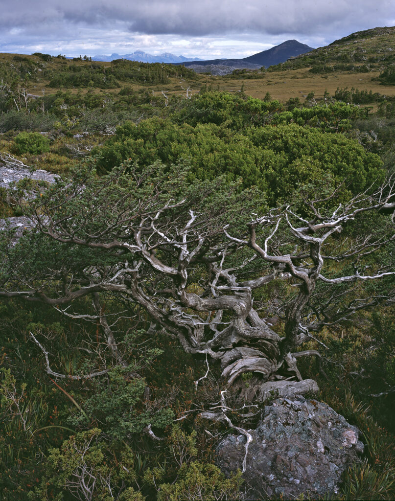
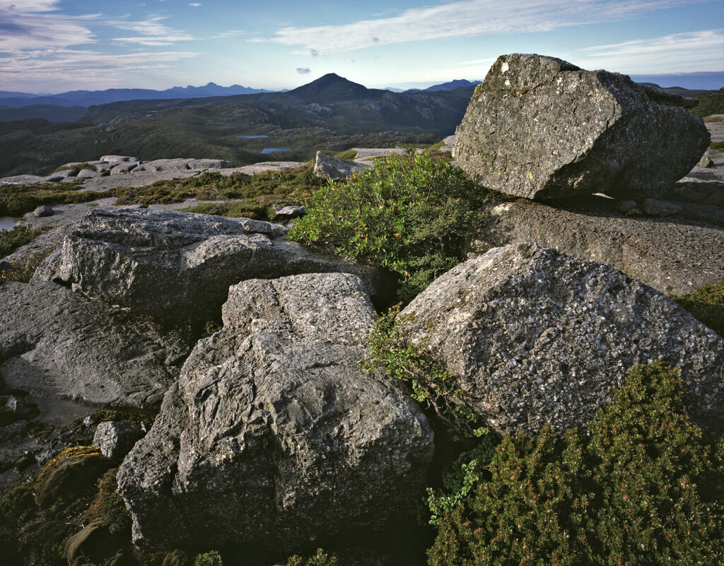
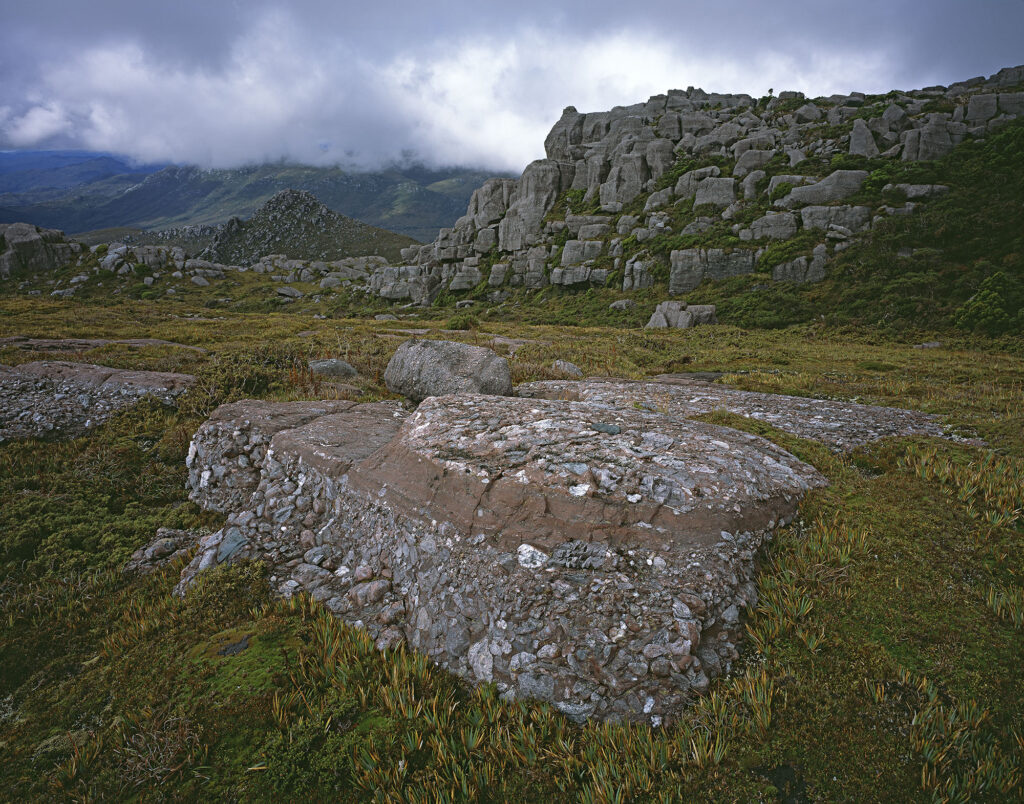
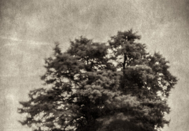
One outstanding aspect of the Tyndall Range is the long absence of fire. As a result, it stands as an isolated “island” of fragile alpine vegetation and other habitats. Add to this the unique geology and past history of glaciation, which has spectacularly sculpted the landscape. Yet, for all its conservation and scientific values, the area remains essentially unprotected.
Compared to many parts of the neighbouring Tasmanian Wilderness World Heritage Area, the Tyndall Range is not remote. It is close to the towns of Tullah, Rosebery, and Queenstown. Despite this, the range saw relatively little visitation for decades compared to areas such as Cradle Mountain, Lake St Clair, and nearby Frenchmans Cap in Franklin-Gordon Wild Rivers National Park. In recent years, social media and an interest in climbing the Abels* have widely publicised the West Coast Range, and visitation of the mountains has increased significantly.
In 2019, the Tasmanian government and tourism authorities released a proposal for Tasmania’s “Next Iconic Walk,” encompassing parts of the Tyndall Range. That proposal has been controversial, firstly because of the threat it poses to the extremely sensitive environment of the Tyndall Range. Furthermore, because the area is subject to some of the worst weather in Tasmania, there is scepticism as to whether the walk will receive the visitation proponents envisage, impacting the claimed economic and tourism benefits. If the proposal goes ahead, the Tasmanian government and Parks Service are planning to have the walk completed by 2028/2029.
For a large-format photographer, the Tyndall Range is a challenging place to work. During my visits, I’ve felt the full brunt of the roaring 40s and the rain that Western Tasmania is notorious for. Even in the worst of weather, my trips to the Tyndall Range have been an extraordinary experience. I hope to continue my photography there before the proposed development goes ahead and irrevocably changes the nature of the area.
The photographs presented in this folio span more than a decade. All were photographed using 4 x 5 transparency film using 65mm, 80mm, 150mm, and 200mm lenses.
*Tasmania’s Abels are named after Abel Tasman, the Dutch explorer. The mountains need to be higher than 1,100 m above sea level and be separated from other mountains by a drop of at least 150 m on all sides. The West Range contains nine “Abels”; two of these, Mount Tyndall and Mount Geikie, are in the Tyndall Range.
Photograph above: Storm clouds reflected in Lake Huntley.


Some superb images Mark. It is a pleasure to view these type of landscapes (that I will likely never get to visit) in such an authentic colour palette. I especially like the King Billy pines above Lake Huntley – your capture brings quite a primordial feel to the setting.
Thank you, Murray. I hope these photographs do give a sense of place, the Tyndall Range really is an extraordinary area, and it’s become a very special place for me. The exposure to weather means that the species that would grow as trees or large shrubs elsewhere are quite stunted , at times it feels like a landscape in miniature.
Hi Mark,
Stunning photos! The West Coast Range should be included in Tasmania’s National Park System.
The ‘Stunted King William Pines above Lake Huntley” photo is superb with its soft light on the sculptured rocks.
I see that the track route for the proposed multi-day iconic walk in the Tyndall Range, which roughly runs between the towns of Queenstown (mining town) and Tullah (hydro town), has been confirmed. The concept plans for the two hut sites have been signed off.
It would be expensive to construct, there is spectacular scenery, geological history, and a diversity of landscapes, and from my experience in that area it would be cold, wet, cloudy, windy for much of the year. The weather conditions would be pretty rough in winter and walking the track would realistically be only feasible in late spring to autumn. That weather will reduce the appeal of camping and increase the demand for the high end private huts. It seems to be modelled on the hut-based multi-day Three Capes Track-style development.
Has the track proposal been released for public comment yet?
Thank you, Gary.
According to the Tasmanian PWS website “The first stage of the Reserve Activity Assessment (RAA) process has commenced. It is expected the final RAA will be released for public comment after easter 2024. Following the finalisation of the RAA a Development Application will be lodged with the West Coast Council.” So far I’ve not seen any opportunity for public comment on the next stage of the proposal.
Your certainly right about the weather, the stunted and wind-pruned vegetation found throughout the West Coast Range, including the Tyndall Range, is evidence of how severe conditions are for much of the year. Part of the rational behind the “Iconic Walks” is to promote these areas to those who are not regular bush walkers, something that could potentially put them in a serious situation without the experience and possibly equipment to deal with it.